


Video Training / Website Development Tutorials →Drone Data Processing (2024)
Published by: E-Learning79 on 9-04-2024, 10:04 |  0
0
Free Download Drone Data Processing (2024)
Published 4/2024
MP4 | Video: h264, 1920x1080 | Audio: AAC, 44.1 KHz
Language: English | Size: 3.10 GB | Duration: 2h 34m
Best practise to process drone data
What you'll learn
Introdution to Drone Surveying Tequique
Cartography and Datum Project
Planning Survey Drone Mission
Download Data and Start Processing
Using Cloud Compare to Filter Point Cloud Drone Survey From Point Cloud to Mesh
Requirements
Gis
Computer Knolodge
Description
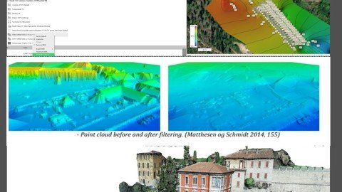
The course aims to illustrate the main drone survey techniques; in its first part the main reference systems, datums, coordinates, satellite detection systems, how to carry out coordinate conversion and above all the problems of altimetry when carrying out surveys with the drone will be explained.The acquisition of aerial photogrammetric data does not exclude the use of other techniques such as GPS for ground points.There are various techniques that concern processing, merging photos, calculating the right degree of image overlap, planning detection campaigns based on obstacles present in the area, or on the types of missions, as in the case of park inspections wind and/or solar.It is clear that the methodologies can be influenced by the objectives of the survey. As regards data processing, there are semi-free web applications such as WebDrone - or more advanced systems such as Metashape and CloudCompare. Aerial photogrammetric techniques date back to the early 1900s but today cloud computing techniques have significantly automated and improved them, allowing height and position values to be extracted from individual pixels of the image. These height and position values must subsequently be corrected with the Datum Local. The new points must be specifically filtered to extract only the points of the terrain and other required structures.The final products can be different, from DTM to DSM to density maps, or even Covariance Maps and deviation between the detected points (beaten) and those perceived by the drone.
Overview
Section 1: Introduction
Lecture 1 Introdution to Drone Surveying Tequique
Lecture 2 Cartography and Datum Project
Lecture 3 Planning Survey Drone Mission
Lecture 4 Download Data and Start Processing
Lecture 0 Using Cloud Compare to Filter Point Cloud Drone Survey
Lecture 0 From Point Cloud to Mesh
Student and Professional
Homepage
https://www.udemy.com/course/drone-data-processing/Buy Premium From My Links To Get Resumable Support,Max Speed & Support Me
Rapidgator
cdxmi.Drone.Data.Processing.2024.part4.rar.html
cdxmi.Drone.Data.Processing.2024.part2.rar.html
cdxmi.Drone.Data.Processing.2024.part3.rar.html
cdxmi.Drone.Data.Processing.2024.part1.rar.html
Uploadgig
cdxmi.Drone.Data.Processing.2024.part3.rar
cdxmi.Drone.Data.Processing.2024.part4.rar
cdxmi.Drone.Data.Processing.2024.part2.rar
cdxmi.Drone.Data.Processing.2024.part1.rar
NitroFlare
cdxmi.Drone.Data.Processing.2024.part2.rar
cdxmi.Drone.Data.Processing.2024.part3.rar
cdxmi.Drone.Data.Processing.2024.part1.rar
cdxmi.Drone.Data.Processing.2024.part4.rar
Fikper
cdxmi.Drone.Data.Processing.2024.part2.rar.html
cdxmi.Drone.Data.Processing.2024.part4.rar.html
cdxmi.Drone.Data.Processing.2024.part1.rar.html
cdxmi.Drone.Data.Processing.2024.part3.rar.html
No Password - Links are Interchangeable
Help Us Grow – Share, Support
We need your support to keep providing high-quality content and services. Here’s how you can help:
- Share Our Website on Social Media! 📱
Spread the word by sharing our website on your social media profiles. The more people who know about us, the better we can serve you with even more premium content! - Get a Premium Filehost Account from Website! 🚀
Tired of slow download speeds and waiting times? Upgrade to a Premium Filehost Account for faster downloads and priority access. Your purchase helps us maintain the site and continue providing excellent service.
Thank you for your continued support! Together, we can grow and improve the site for everyone. 🌐
Related News
-
{related-news}
Comments (0)

Information
Users of Guests are not allowed to comment this publication.
Search
Updates
Partner
» TutBB
» Byte
» Crawli
» Warezomen
» Warez-DDL
» Raidrush
» KATZCD
» Free Ebooks Library
Your Link Here ?
(Pagerank 4 or above)
» Byte
» Crawli
» Warezomen
» Warez-DDL
» Raidrush
» KATZCD
» Free Ebooks Library
Your Link Here ?
(Pagerank 4 or above)