


Software →OkMap Desktop 17.6.1 Multilingual (x64)
Published by: Baturi on 22-08-2022, 10:57 |  0
0
OkMap Desktop 17.6.1 (x64) Multilingual | 406 Mb
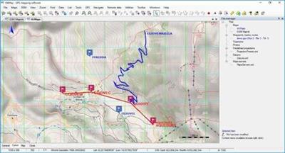
OkMap is an interactive software which allows you to work on your computer screen with web maps or digital maps that you have either bought or scanned. OkMap can also import vectorial data from the most common formats and DEM data relevant to height information. Through these maps, you can organize your paths by creating waypoints, routes and tracks on your computer monitor, and upload this data to your GPS. OkMap sets automatically altitude data and estimates travel times.
Features:
OkMap is an interactive software which allows you to work on your computer screen with web maps or digital maps that you have either bought or scanned. OkMap can also import vectorial data from the most common formats and DEM data relevant to height information.
Through these maps, you can organize your paths by creating waypoints, routes and tracks on your computer monitor, and upload this data to your GPS. OkMap sets automatically altitude data and estimates travel times. Furthermore OkMap provides you also with autorouting and geocoding functions.
Data collected by your GPS can be downloaded on your computer, stored and displayed on the maps. They can also be used to create different types of statistics.
By connecting a GPS to your laptop, you can Description your position on maps in real-time. If you are connected to the network you can constantly send your position to a remote computer, or receive the position of your companions on your computer and display the related tracks on maps in real time.
Whats New:
GPSBabel: New version 1.6.0.
C ++: New version 14.23.27820.0.
Enabled the management of vector data in web maps.
New function: Export vectorial data in OkMap format.
Preferences: Receiving remote data at startup (OkMap and GpsGate).
FIX: Importing vectorial dаta: The datum was not converted in the calculation of the metric coordinates.
FIX: File - Save - Map - KMZ: It always oriented the image to the north.
FIX: Tracks: The navigation bitmap overwrote the trace end bitmap.
FIX: Calculate distances: Incorrect management of the measurement window on the map change.
FIX: Menus were not enabled / disabled after drawing a pie / icon / comment.
Operating System:Windows 7 or higher (64-bit only)
Home Page-
https://www.okmap.org/Language:Multilingual

Download From UploadCloud
https://www.uploadcloud.pro/exq200thohdh/wccbk.OkMap.Desktop.17.6.1.x64.Multilingual.rar.html
![]()
https://uploadgig.com/file/download/b5ad7c9d948c10D1/wccbk.OkMap.Desktop.17.6.1.x64.Multilingual.rar
![]()
https://rapidgator.net/file/fa54dbf4068af5d251f263c43a1fa729/wccbk.OkMap.Desktop.17.6.1.x64.Multilingual.rar.html
![]()
https://nitroflare.com/view/B9BFB78D9588C8C/wccbk.OkMap.Desktop.17.6.1.x64.Multilingual.rar
https://www.uploadcloud.pro/exq200thohdh/wccbk.OkMap.Desktop.17.6.1.x64.Multilingual.rar.html

https://uploadgig.com/file/download/b5ad7c9d948c10D1/wccbk.OkMap.Desktop.17.6.1.x64.Multilingual.rar

https://rapidgator.net/file/fa54dbf4068af5d251f263c43a1fa729/wccbk.OkMap.Desktop.17.6.1.x64.Multilingual.rar.html

https://nitroflare.com/view/B9BFB78D9588C8C/wccbk.OkMap.Desktop.17.6.1.x64.Multilingual.rar
Please Help Me Click Connect Icon Below Here and Share News to Social Network | Thanks you !
Help Us Grow – Share, Support
We need your support to keep providing high-quality content and services. Here’s how you can help:
- Share Our Website on Social Media! 📱
Spread the word by sharing our website on your social media profiles. The more people who know about us, the better we can serve you with even more premium content! - Get a Premium Filehost Account from Website! 🚀
Tired of slow download speeds and waiting times? Upgrade to a Premium Filehost Account for faster downloads and priority access. Your purchase helps us maintain the site and continue providing excellent service.
Thank you for your continued support! Together, we can grow and improve the site for everyone. 🌐
Related News
-
{related-news}
Comments (0)

Information
Users of Guests are not allowed to comment this publication.
Search
Updates
Partner
» TutBB
» Byte
» Crawli
» Warezomen
» Warez-DDL
» Raidrush
» KATZCD
» Free Ebooks Library
Your Link Here ?
(Pagerank 4 or above)
» Byte
» Crawli
» Warezomen
» Warez-DDL
» Raidrush
» KATZCD
» Free Ebooks Library
Your Link Here ?
(Pagerank 4 or above)