


E-Books →Bronze Age Barrow and Pit Alignments at Upton Park, South of Weedon Road, Northampton
Published by: book79 on 12-11-2024, 12:45 |  0
0
Free Download Yvonne Wolframm-murray, "Bronze Age Barrow and Pit Alignments at Upton Park, South of Weedon Road, Northampton"
English | ISBN: 1803276223 | 2023 | 106 pages | PDF | 36 MB
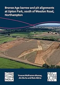
MOLA (Museum of London Archaeology) was commissioned by RPS Group PLC, on behalf of Morris Homes, to undertake archaeological work on land at Upton Park south of Weedon Road, Northampton. Two adjacent palaeochannels crossed the western extent of the site and are likely to have dated to the Pleistocene period. The earliest evidence of human activity consisted of a background scatter of Neolithic flint. The first feature was an isolated barrow that was established in the early Bronze Age. A later unurned cremation was cut into the backfill of the recut ditch and radiocarbon dated to the end of the early Bronze Age or the beginning of the middle Bronze Age. At least one isolated early Bronze Age pit was found in another part of the site. Parts of two late Bronze Age/early Iron Age sinuous pit alignments were recorded over nearly 0.5km within the site with c257 pits revealed. An estimated 66% of these pits by volume were examined. This is the first time in the county since Wollaston Quarry in the 1990s that pit alignments were seen over such a distance within a single planning application. The archaeological excavation of these has resulted in them being by some distance the two most examined pit alignments in the county, if not the region. Both had most likely fallen out of use by the early Iron Age, but a middle Iron Age date should not be ruled out. In the northern and southern pit alignments there were 16 and seven areas respectively where there were different variables in the pits such as circular or rectangular plan form (and some pit areas had be recut by ditches), which may suggest they had been constructed and maintained by different gangs/communities over probably hundreds of years. Relatively little detailed work has been recorded on this enigmatic feature type. The extensive work and examination of the two pit alignments at Upton has allowed a typology of the variable areas of pits (and related ditches) to be postulated. A detailed discussion has compared these features in a local, regional and national context. Future recommendations for excavation of pit alignments have been recorded. A Roman trackway lay within the western part of the development area and it was part of the routeway network located around the nearby Duston Roman town. Medieval drainage ditches and field systems relating to part of the medieval settlement of Upton lay within the eastern part of the development area.
Read more
Buy Premium From My Links To Get Resumable Support,Max Speed & Support Me
Links are Interchangeable - Single Extraction
Help Us Grow – Share, Support
We need your support to keep providing high-quality content and services. Here’s how you can help:
- Share Our Website on Social Media! 📱
Spread the word by sharing our website on your social media profiles. The more people who know about us, the better we can serve you with even more premium content! - Get a Premium Filehost Account from Website! 🚀
Tired of slow download speeds and waiting times? Upgrade to a Premium Filehost Account for faster downloads and priority access. Your purchase helps us maintain the site and continue providing excellent service.
Thank you for your continued support! Together, we can grow and improve the site for everyone. 🌐
Related News
-
{related-news}
Comments (0)

Information
Users of Guests are not allowed to comment this publication.
Search
Updates
Partner
» TutBB
» Byte
» Crawli
» Warezomen
» Warez-DDL
» Raidrush
» KATZCD
» Free Ebooks Library
Your Link Here ?
(Pagerank 4 or above)
» Byte
» Crawli
» Warezomen
» Warez-DDL
» Raidrush
» KATZCD
» Free Ebooks Library
Your Link Here ?
(Pagerank 4 or above)